[NOTE: This is an essay I wrote around 1957, describing my first trip into the high country of Yosemite National Park. Like those in “A June Jaunt in the Yosemite,” the descriptions are a bit larger than life but, again, I plead that I was only 16 years old, and obviously hoping to someday replace John Muir as the greatest story teller of the High Sierra.]
It was only a month after my June 1956 trip to Yosemite Valley that the Sierra Club had another trip to the Sierra, this time beginning from Tuolumne Meadows. And again Charlie and I were with them. Just after midnight on a Saturday in July we arrived at Lake Tenaya, where we spent a short night. Arising well before the others, I climbed around the glacial slopes above the lake and enjoyed a red sunrise on Mt. Hoffman. Tenaya, for those not acquainted with Yosemite lore, means “Lake of Shining Rocks.” The name is no misfit! The polishing done by the long-departed glaciers has left its mark on the rocks of Tenaya.

Tenaya Lake (taken on a later trip)
People started stirring in camp and before long we were on our way to Tuolumne Meadows. The Meadows lie in a basin surrounded by high mountains. In July it is a lovely green expanse through which meanders the Tuolumne River. To the north, Mt. Conness and its surrounding peaks are seen, while to the east rise Lembert Dome, Mt. Dana and the Kuna Crest. But to the southwest is the greatest view of all. Cathedral and Unicorn peaks lift their snow-covered heads above the meadows and forests, peaks to stir the blood of any mountaineer. However, this was a backpack trip and time was limited, so we had to leave the peaks for (hopefully) another time.
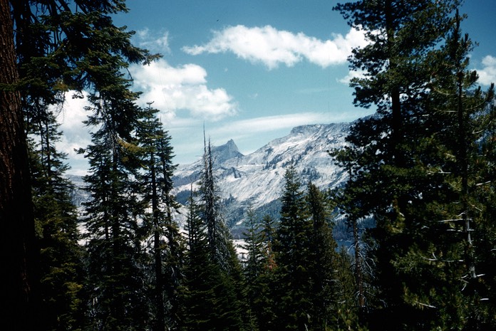
Cathedral Peak from the Mines Road
Charlie and I were joined by a young Navy man, and started off ahead of the main group toward Tuolumne Pass. Did I say “pass?” The pass has a "summit” several miles wide, and you walk along a high plateau for an hour before you see the sign marking the “top.” But while the trail to the pass may not be rugged or spectacular, the surrounding mountains certainly are. The first peak to draw the interest is Vogelsang with its high, smooth front and its extensive snowfields. Vogelsang Lake, at the mountain’s base, was our goal for the night.
We missed the trail to the lake, but the country was wide open, and cutting cross country was no problem. We reached the lake easily, and couldn’t have asked for a more picturesque campsite. Snow and ice still covered over half the lake, with fields of snow stretching off in all directions to the dark granite of the peaks. We found ourselves among the first to arrive at camp, although the Richmonds (more later about them) had already started up Vogelsang Peak. We dumped our packs, and quickly followed them.
The climb to the north ridge of Vogelsang was accomplished with only a little bit of easy rock-climbing. Then, it was just a walk along a high sandy plateau to the south summit. From there, we had great views in all directions, made truly amazing by a very active thunderstorm over Mt. Lyell. We quickly took in the view of mountain after mountain, snow-covered lake after lake, but decided the storm was getting a little too close for us to linger. Snow fields made the trip down pretty quick, as we skidded our way down in a ski-less glissade. We arrived back at camp just as the storm broke over us, complete with thunder, lightning, rain and hail. But, like most summer afternoon storms in the Sierra, all was dry and clear before nightfall.
Morning dawned bright and clear, with only a few wispy clouds over the crest. As the main party was returning over Tuolumne Pass, the three of us decided to take a cross-country route through the lakes basin lying southeast of Fletcher Lake. Almost everything was still snow-covered, and the only living things in the basin beside ourselves seemed to be the rosy finches and pipits that were everywhere, adding a note of cheer to the awesome surroundings.
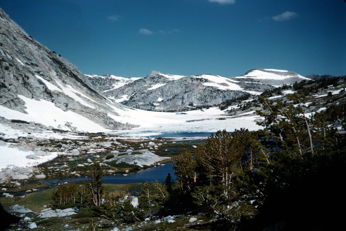
Fletcher Lake Basin
We reached the top of the pass between our basin and Ireland Lake, and were greeted by a pika that hid beneath a rock as we approached, and by a chipmunk that went sliding down a snowbank with astonishing speed toward whatever lay below. It – and we – had a great view down on Ireland Lake, still wrapped in its blanket of winter ice and snow. Clouds had built up during the day and added themselves to the scene of black cliffs and white snow.
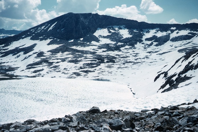
Ireland Lake
A long glissade took us to the shores of Ireland Lake where, once again, we found the Richmonds ahead of us. They had stopped for a rest, and offered us lemonade, which we gladly accepted. An hour more of sliding and scrambling brought us all to the Evelyn Lake Trail which we followed to the Lyell Fork of the Tuolumne River, where we met the rest of the Sierra Club party.
As we pushed on toward the Meadows, a storm caught up with us, more intense than the previous day’s activity. Lightning flashed over Lembert Dome and Kuna Crest, and deafening thunder roared around us, accompanied by what seemed at the time the wettest rain I had ever walked in. We temporarily re-named Lyell Fork Meadows the Tuolumne Bog. Rafferty Creek had become an obstacle - it was no longer a meandering stream but a raging torrent. There were a few touchy places on a wet log we found for a bridge, but everyone came across safely.
We finally straggled into the campground and shared the rangers’ roaring fire with them, where we were able to partially dry out. The drive out of the Meadows was more like a boat ride than a car ride in places, with Yosemite Creek (the source of Yosemite Falls) running over the road. After that, the rain let us alone and so we concluded our adventure in Vogelsang.
Oh yes, we met the Richmonds at the Pine Cone Restaurant in Merced, when we stopped for dinner!
* * *
[AFTERWORD - 2004: Other than my use of grandiose adjectives, I think this piece tells it pretty much as it occurred. As I recall, the storm from the top of Vogelsang really was “truly amazing,” with lighting strikes all over the mountains around the head of the Lyell Fork. We certainly were stupid to be on top of a peak with that much weather so close. But it was exhilarating.
One thing I didn’t tell - probably because I was a teenager and not proud of it - is that I had a pretty bad case of mountain sickness at Vogelsang Lake after the peak climb. It was the first (but not the last!) time I had experienced it, as it is a common response to gaining too much altitude too quickly for your body to acclimate. I don’t remember if I vomited, but I had all the other symptoms - bad headache, aching body, general stomach upset. I got in my sleeping bag for awhile after the hailstorm and just “dozed it off.” I was fine later, and the next day.
Another thing I didn’t mention, because it wouldn’t have really meant anything at that time, was the Mines Road. The trip from Crane Flat to Tuolumne Meadows in the ‘50s was over a real mountain road. It was paved but only about a lane and a half wide, and had been built around the trees and rocks, not through them like highways are built. It was a road that even a modern day pickup and camper would have had a few problems on, and no larger recreational vehicle would have even attempted it. A lot of people made the trip to Tuolumne Meadows - and on over Tioga Pass - but you had to really work for it, so the Meadows were seldom crowded, even in high summer. When Sally and I went there only five years after this trip, we found that the National Park Service had widened and straightened the road, and all kinds of vehicles were roaring up and down it. Break-ins and vandalism of cars and camps had been almost unknown in the Meadows when the Mines Road was the only access; they became common after the new highway was completed. (Thanks to the U. S. Government and the Park Service’s “Mission 66,” a program to “improve” visitor use of the parks!)]
MORE ESSAYS
To the Writing It Down Homepage
Leave a Comment: symbios@condortales.com